 July 7th 2024 was the 18th running of the Sydney Metropolitan Turkey Trot, the premier point to point event of the Sydney orienteering calendar. There were three courses: Short (8km), Medium (12km) and Long (20km). Each course had multiple maps. The start and finish location was at Putney Park, and the course traversed parks, paths and cycleways of Putney, Rhodes and Concord.
The Turkey Trot course standard is moderate, requiring basic navigation skills in map reading and route choice. Non-orienteers will have little difficulty with this standard yet it will still challenge in terms of route choice for the experienced orienteer.
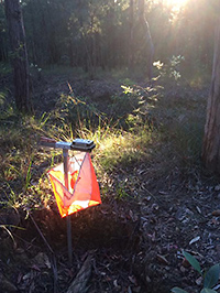
The orienteering maps have a series of checkpoints (controls). Runners decide the best route between controls. All runners carry a SportIdent (SI) electronic timing stick to record control visits and finish times. (Timing sticks are available for hire).
Each distance (long, medium and short) has three classes:
Above is an image gallery of the 2017 Long Course which had four map changes. Click on the images to see a larger version of the map.
Start Times
Runners arrived at their start location approximately 30min prior to their start time.
| Long Course |
Medium Course |
Short Course |
|
| 9:00 am |
9:15 am |
9:30 am |
MTBO Start: 8.45am (regardless of course) |
2024 Location and Assembly Area
The assembly location for the 2024 Turkey Trot was at the south end of Putney Park. Adjacent to Pellisier Rd.
History
The Sydney Metropolitan Turkey Trot was first held in November 2005 and ran from Castle Hill to Parramatta Park. Since then it has been an annual fixture on the orienteering calendar and in recent years has found a home on the first Sunday in July. Below are some of the combined maps of the Turkey Trot Long courses.
Course Maps Gallery