 Saturday July 4th 2026
will be the 20th Sydney Metropolitan Turkey Trot
The Sydney Metropolitan Turkey Trot, is the premier point to point event of the Sydney orienteering calendar.
There will be three courses: Short (8km), Medium (14km) and Long (20km). Each course had multiple maps. The course will travers the parks, paths and cycleways of Lane Cove Valley and surrounding suburbs.
The Turkey Trot course standard is moderate, requiring basic navigation skills in map reading and route choice. Non-orienteers have little difficulty with this standard yet it still challenges in terms of route choice for the experienced orienteer.
The orienteering maps have a series of checkpoints (controls). Runners decide the best route between controls. All runners carry a SportIdent (SI) electronic timing stick to record control visits and finish times. (Timing sticks are available for hire).
Each distance (long, medium and short) has two classes: Mens and Womens
History
The Sydney Metropolitan Turkey Trot was first held in November 2005 and ran from Castle Hill to Parramatta Park. Since then, it has been an annual fixture on the orienteering calendar and in recent years has found a home on the first Sunday in July. Below are some of the combined maps of the Turkey Trot Long courses. The theme of this first Turkey Trot was "from the hills to the river".
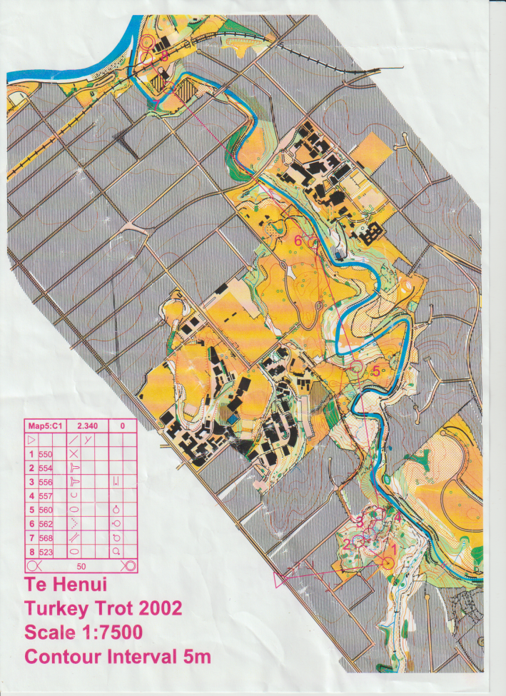
When Barry Hanlon and Janet Morris were on an orienteering holiday in New Zealand in 2002 they entered the Taranaki Turkey Trot. This was the inspiration for planning a similar event in Western Sydney. The Taranaki event was organised by Egmont Orienteers, now Taranaki Orienteering Club. The theme was "from the mountain to the sea". It started in the southern suburbs of New Plymouth on the lower slopes of Mount Taranaki and, after five map changes, finished on the ocean beach at Fitzroy Park, near the centre of the city. Below you can see a copy of the final map which had several river crossings on the gravel bed of the Te Henui Stream.
Course Maps Gallery. . .